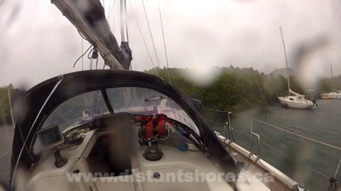
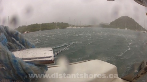
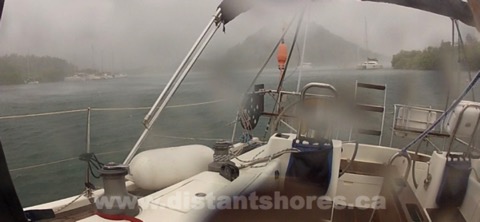
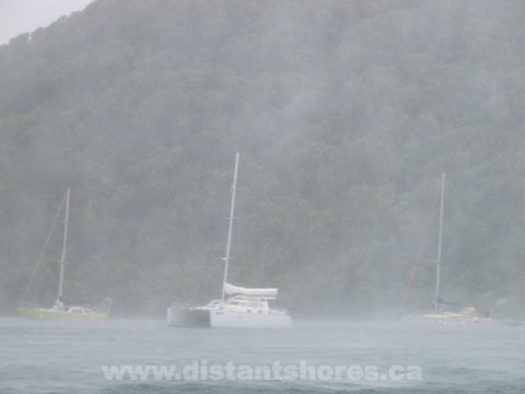
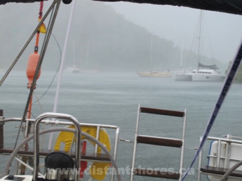
Storm off Cape Hatteras
We left Beaufort and headed out the inlet to the ocean, then east to the excellent anchorage at Cape Lookout.
This spacious anchorage is a great stop for a day or two wait for weather, and you can even get ashore to climb the lighthouse mid-May through Mid-September.
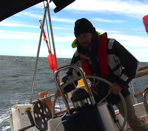
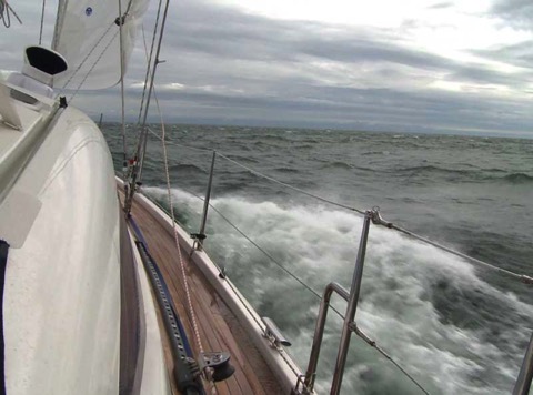
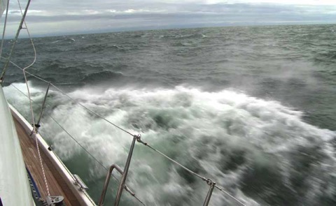
We got a good start but after the first night the forecast changed for bad weather to build sooner and come stronger on our second day at sea.
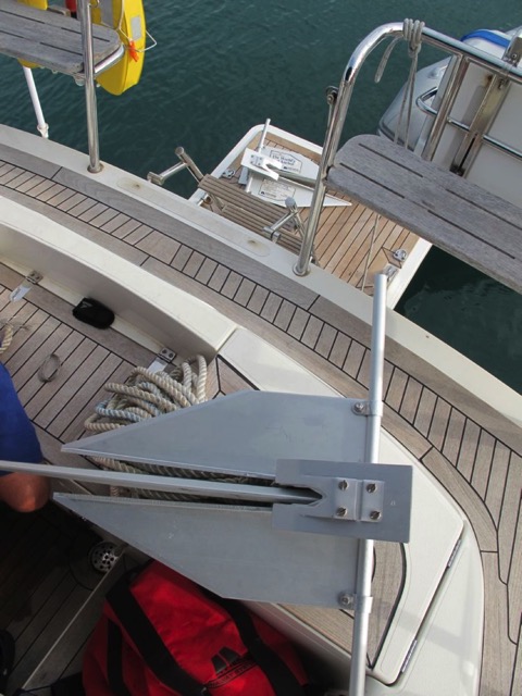
With our mast height of 71 feet, there is no place we can pull in along this coast until we reach Rudee Inlet at Virginia Beach so we reefed down and carried on.
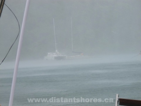
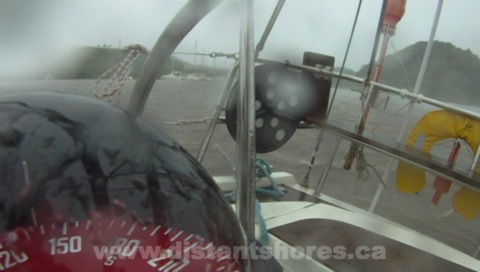
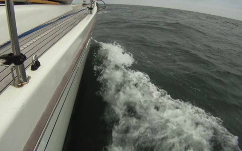
Radar is an excellent tool for plotting storms. On the left we're looking at the coast of Cape Hatteras and then the storm cell passing right in front of us. We've set the radar at the 6 mile range so the heavy rains are about 2 miles ahead.
The radar has helped us dodge the worst of the storm then it's just a few more miles to our planned stop for the night.
Check out the whole video below as we take you along on this journey.
What to do in a hurricane
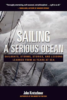
Sailing a Serious Ocean
Sailing a Serious Ocean is the same. John describes some of the most harrowing and exciting ocean conditions he has encountered, and with humility and clarity describes what he did right and wrong. As with all of John's books, his writing is evocative and he paints a picture of offshore passages. Winds blowing, waves crashing aboard, sails strained past the breaking point. But his stories are rich with technical details and perfect for those with less experience hoping to learn more. Each chapter also has additional sidebars that expands on details, such as "thoughts on waves" "weather information sources" "features of a bluewater yacht" and more. The combination of well-told stories and clear technical details makes a very readable format. The book that has got enough hard information presented alongside that you have gained real usable knowledge by the time you get to the end. And you have an excellent insight into the mindset of a fantastically experienced sailor. You might even find yourself signing up for a passage with John to learn offshore sailing yourself. Did I mention he offers offshore training? (www.yayablues.com)
Chapter Seven "Storm Strategies" - for this chapter alone the book is worth the price! But the whole book is a gem. Do yourself a favour and pick up a copy of "Sailing a Serious Ocean". After you have perused it and appreciated John's experience and storytelling, you can refer back to it as you plan your own passages on the Serious Ocean. I am tying in a third reef and going out to practice "Heaving-to" and "Forereaching".
You can pick up a copy from John’s website or from the Nautical Mind in Canada.
August, look out we must!
May no way
June too soon
July stand by
August look out we must
September remember
October all over
Well here comes August and we are still keeping a sharp eye out. Hurricanes can't just pop into existence out of nothing, generally ones that hit the Caribbean form from a depression that is coming across the Atlantic from Africa - a tropical wave. So you get a few days warning at least. Then the choice is to run away or choose the best place to batten down and somehow weather the storm.
Running away
Its generally acknowledged that hurricanes will not go much south of Grenada as the spinning effect of the earth's rotation - the Coriolis Effect - is reducing the closer we come to the equator. Here is an image showing the tracks of hurricanes over the last 150 years. Looks like we can run south to Grenada or Trinidad and be out of the path of all but the very occasional storm. If one did seem to be heading to the southern side of the range we are then ready to run even further south?

Where to Hide
Where would be a safe place to hide is a trickier question. Many cruisers we have met this summer have picked out a nice summer spot and are planning to hide nearby if a storm threatens. There are still many boats in Marin Martinique and are planning to stay if a hurricane comes. Our experience in the mangrove for a direct hit of Tropical Storm Chantal (in Marin) made it clear we could be safe there with winds up to 50-60 knots. But increasing to a proper hurricane at say 80 knots means forces are doubled. I am not at all confident we would have been safe where we were, and I think there would have been serious problems out in the main harbour. Nearby Rodney Bay St Lucia looks like a safer alternative, and Marigot St Lucia also looks safer. But when winds get higher and anchorages get crowded with last minute hastily-anchored charter boats, I think a truly safe hurricane hole will still be a very risky place to weather a storm.
Distant Shores II - Hurricane Plan
Perhaps my choice is reflected in our name... in the event a "proper" hurricane is coming our choice will be to head for "Distant Shores". We will run south. The destructive path of the hurricane isn’t very wide and if we can get out of the worst winds and south of the main-event, we will have a blustery day as it heads past to the north. That’s our plan anyway!
Each hurricane season and each tropical storm/ hurricane is very different and we will judge as they come, but a well-found cruising boat should be able to make the distance needed to get out of the path of the storm given the proper notice. This strategy is more difficult if you are further north, but from here in the Southern Grenadines the decision is simple. Go south. And nowadays we can have the proper notice with such good weather forecasts and internet access to the information from just about anywhere. Even at anchor in the lovely and remote Tobago Cays last week we had reasonable internet access for just $1//day and could start the day with a coffee and a look over the National Hurricane Center forecast.
Is there a storm over the horizon?? Look out we must!
Have you been in a hurricane or tropical storm? What would you do if you were cruising and a storm was coming?
Hurricane Blog Entries
Part 1 Hurricanes - Watching the Weather
Part 2 Tropical Storm Likely
Part 3 Tropical Storm Chantal is Coming
Part 4 Securing in a Mangrove
Part 5 Tropical Storm Chantal Arrives
Part 6 Tropical Storm Moves Off
We filmed all this for an episode in Season 9 - Martinique Tropical Storm here on Vimeo
Check out the whole Tropical Storm Adventure plus lots more sailing on Season 9 Distant Shores on Vimeo in Hi-Def Download
Tropical Storm Moves Off
We haven't budged and have had no visible problems. I will go into the mangroves later and check how our "mangrove lines" did but all appears to be well.
Meanwhile everyone is poking their heads out, examining their boats and sniffing the air to make sure Tropical Storm Chantal is really gone!!
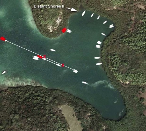
Here is the updated graphic showing what happened to the boats in our little mangrove community (see original here).
The forward-most catamaran (lower-centre) dragged in the strongest gusts from the SE. They dragged back and turned sideways, and managed to hit directly side on to the bows of the monohull behind them. They stayed that way for some time (15-20 minutes?) and I was amazed that the monohull's anchor didn't drag sooner. But with a large cat side-on to the wind the strain must have been enormous. So eventually the pair of them dragged back further and crashed into the larger catamaran.
The two boats hung for a few minutes then the first catamaran continued to drag right out of the anchorage - I didn't see them again. The monohull is about 40 feet and they managed to raft up to the large catamaran (a gorgeous 50 footer) and the two stayed rafted throughout the rest of the storm.
Here is the bow of the big cat - crunched in but I couldn't see any more damage.
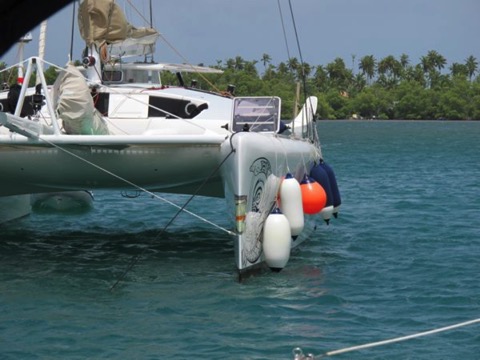
Note the many fenders hung down. Since there were crews aboard all the boats throughout the storm they were able to prevent much more damage by putting the fenders down as the boats came together. Also there was no more than a small chop since our mangrove was so small and enclosed with no chance for the seas to build up and cause the boats to bounce.
On the radio there has been much talk of boats dragging out in the main harbour. But no one was hurt and no boats sunk I think! Really only a few boats dragged their anchor or broke loose their mooring. The problem, as in our mangrove, is that one boat dragging often turns into a disaster for 2,3 or more other boats.
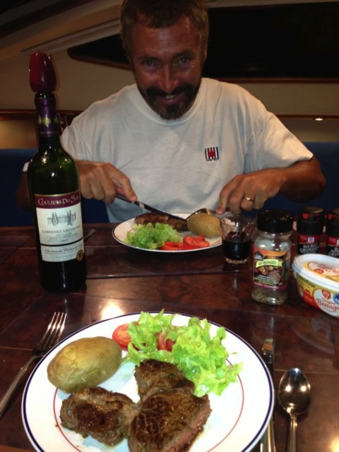
Storm Over!! Incredibly it is a calm afternoon - was it just this morning we took the genoa down?? The storm came and went in less than 3 hours. I run in to the grocery to buy a steak for dinner. We deserve it!!
Hurricane Blog Entries
Part 1 Hurricanes - Watching the Weather
Part 2 Tropical Storm Likely
Part 3 Tropical Storm Chantal is Coming
Part 4 Securing in a Mangrove
Part 5 Tropical Storm Chantal Arrives
Part 6 Tropical Storm Moves Off
We filmed all this for an episode in Season 9 - Martinique Tropical Storm here on Vimeo
Tropical Storm Chantal Arrives
Whoa... big winds from the NE-E this morning (July 9) with Tropical Storm Chantal approaching but we are snuggled behind our mangrove!
First thing this morning we took down the big genoa and folded it up but then the wind got up and we didn’t have a chance to take down the smaller jib. Not a worry I think since the forecast is for 50 knots gusting 60 knots. Not full hurricane strength. But I have tied off the furling drum. Normally the furling system relies on the furling line to keep the sail furled but I think it's a good idea to tie the drum directly so it definitely can’t come undone. (We saw the danger of this when we went through Hurricane Bertha in New Bern, North Carolina, a few years back which we documented in the Cruising with the Shards DVD.)
Otherwise all is secured.
0930 - Wind starts gusting from the NE and that’s over the hill for us so we see almost no wind on deck. The small boat next to us is completely in the wind shadow. Our mangroves seem to be holding well.
1000-1030 - Wind is from the ESE and the fortress FX37 is holding the stern up into the wind. These gusts are 50 knots. Some higher I think. In the strongest gusts our neighbours disappear in the driven spray.
The wind seems stronger at the far end of the bay where the 5 sailboats are anchored.
Here is a closeup view. In these gusts the catamaran here later drags anchor and hits the monohull to the right of the picture.
1100 - The cat has hit the monohull and the closer cat has dragged into the mangroves.
Another close-up shot through the driving rain. The far cat has dragged on top of the mono and after I took this shot they both drag on top of a larger catamaran...
Finally the wind comes from the South and seems about as strong as before. Now almost all the strain is on our anchors, with the Fortress to the SE taking the brunt of it. As far as I can tell we do not drag at all. To set the Fortress before the storm we motored forward at 2000 RPM with the bow coming to a meter away from the mangrove. Now with the full wind blowing up over 50 knots we do not budge and the bow stays clear of the mangrove.
Around 1130 the winds suddenly drop to 10-12 kts and it is over. Then clean-up begins...
Hurricane Blog Entries
Part 1 Hurricanes - Watching the Weather
Part 2 Tropical Storm Likely
Part 3 Tropical Storm Chantal is Coming
Part 4 Securing in a Mangrove
Part 5 Tropical Storm Chantal Arrives
Part 6 Tropical Storm Moves Off
Check out the whole Tropical Storm Adventure plus lots more sailing on Season 9 Distant Shores on Vimeo in Hi-Def Download
Securing in a Mangrove
"Secure your boat in a mangrove!" Most Caribbean experts agree the mangrove is the safest place for a boat to be in a tropical storm. But actual details on the process are scarce. So, with Tropical Storm Chantal approaching, here is the first time we have tied up in a mangrove and how we did it.
Our goal was to have the boat bow-in to the mangrove so rudders and prop would be protected if anything slipped and we were pushed further in. Also it gets quite shallow close to the mangrove so most boats couldn’t get very close if they went stern-to.
We wanted to use our main 33KG Rocna anchor so we chose a spot where we could lay out 40-50 meters of chain. Then we dropped it and backed up toward the mangrove, setting the anchor with 2000RPM in reverse. Then we spun the boat around, dropping out enough chain so it would stay slack and hang under the boat as we turned. My plan was to pick up the chain later with our chain-hook snubber so we could secure the anchor to the stern, and leave a slack loop up to the bow. We have 80 meters of chain so this worked fine.
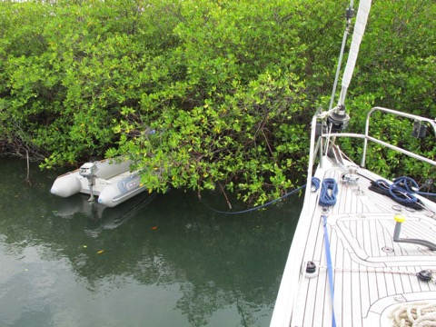
With the bow toward the mangrove we drove the bow right up to it to gently rest at the edge of the mangrove. I ran a line quickly ashore so we wouldn’t drift off again using a convenient root in the mangrove, but we would re-install these more carefully later.
Next I went up to the bow in the dinghy, lifted up a loop of the slack anchor chain, and handed along it until I was back at the stern. Then I connected our anchor snubber and a line to attach it to a stern cleat. The plan was to tighten this up later when everything else was installed.
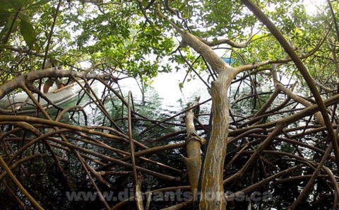
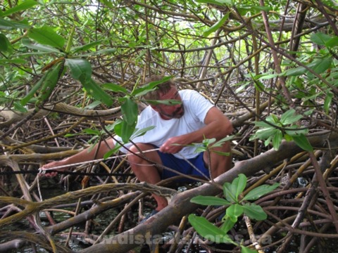
Then off we went into the mangroves to attach lines to big secure mangrove growth...
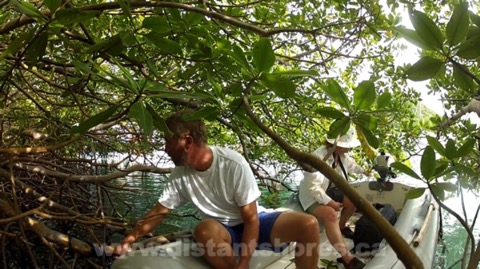
Note the small mangrove roots and the bigger central "trunks". I tied a dockline to a big strong mangrove using a couple of loops to spread the load along the trunk and reduce chafe.
But I wanted to spread the load further. So I connected 2 additional lines from the first big one, on to other mangroves so the strain would be spread out to 3 different mangrove trunks. I tried to organize these so they would continue in more-or-less the same direction.
We now have 8 lines attaching to the mangrove, coming back to three heavy docklines and back to the bow. These are planned to take into account the main winds being from the NE-E-SE-S and finally SSW as the storm passes away. Our bow is oriented to the NE so we will hang on the mangroves as the storm approaches, then have it side-on as the wind builds and the strongest winds from the SE-S as the storm passes. This would be from our stern quarter and we would be hanging mainly on our anchors. If we do drag we will go up into the mangrove with the bow.
Next we set out the 2 additional stern anchors - both Fortress aluminum anchors.
We carry a Fortress FX23 and a bigger FX37.
I wanted the FX37 to be the main one so we set that toward the SE and brought the line back to the stern cleat. (note the nice anchor line bag - always kept neatly stowed with the line flaked carefully. The line will always run out smoothly with no tangles so I can just back up letting it out as I back up to the boat.
To eliminate chafe I wanted to cleat it off. To get it tight I used a line with rolling hitch to winch it up tight, then take in the anchor line.
Next we set the 3rd anchor, our Fortress FX23, and finally, tightened and adjusted all the lines so we would be ready. All told this took more than 4 hours and it was getting on to dusk... storm Chantal due the next morning with winds building by 0900...
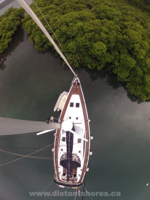
This is a Google Earth snapshot where I have put us in our position in the mangrove. You can see no swell should ever penetrate here.
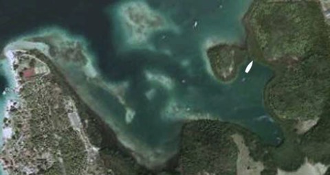
Note we are not to scale - we are much smaller in reality - see below with the other boats here.
There are also boats all along the right side of the mangrove, one astern of us stern-to the mangrove and 5 have anchored in the lower channel and middle. No room for anyone to anchor where we are and it is all full of everyone’s anchors. Most people have put floats on their anchors. Here is a rough plan of the mangrove.
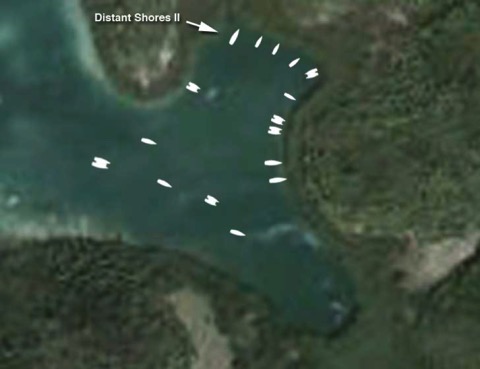
The wind forecast is to build from the NE then E and SE as it arrives. Forecast strength is 50 with gusts of 60 knots. The strongest winds are forecast to come from the SE-South which we will take on the beam-quarter.
Hurricane Blog Entries
Part 1 Hurricanes - Watching the Weather
Part 2 Tropical Storm Likely
Part 3 Tropical Storm Chantal is Coming
Part 4 Securing in a Mangrove
Part 5 Tropical Storm Chantal Arrives
Part 6 Tropical Storm Moves Off
We filmed all this for an episode in Season 9 - Martinique Tropical Storm here on Vimeo
Check out the whole Tropical Storm Adventure plus lots more sailing on Season 9 Distant Shores on Vimeo in Hi-Def Download
Tropical Storm Chantal is coming
Hurricane Blog Entries
Part 1 Hurricanes - Watching the Weather
Part 2 Tropical Storm Likely
Part 3 Tropical Storm Chantal is Coming
Part 4 Securing in a Mangrove
Part 5 Tropical Storm Chantal Arrives
Part 6 Tropical Storm Moves Off
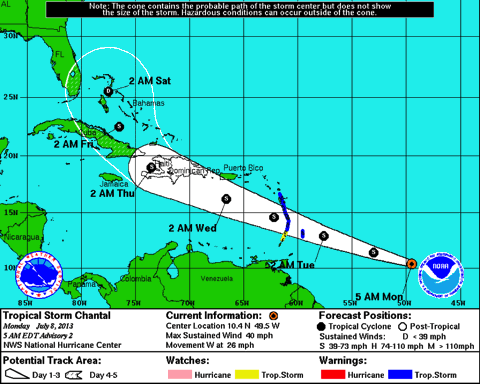
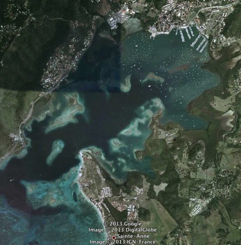
This mornings advisory shows the newly named Tropical Storm Chantal heading directly toward us in Martinique. The storm is due to arrive tomorrow around midday. So this morning we will head in to Marin. This is one of Martinique’s best hurricane holes. Note the large protected harbour, many anchorages and mangroves to the lower right. I think this is one of the best protected harbours in the Eastern Caribbean. However it is a popular harbour and charter base so will have a number of boats in it already. We will see what it looks like as the day goes on. I hope to find a spot in a corner at the bottom of the photo. We looked at this a few days ago.
We also went in to explore Baie des Anglais on the south east. This also looked very good and has no local boat population. It could be a possibility.
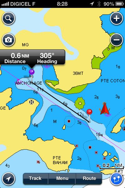
Here is Baie des Anglais from our Navionics charts on the iPhone. No we don’t navigate with our phone, but I did happen to grab a screenshot with the excellent Navionics App as we were anchored in the bay (we are the red triangle).
We will report back when we get secured at anchor today.
Hurricane Blog Entries
Part 1 Hurricanes - Watching the Weather
Part 2 Tropical Storm Likely
Part 3 Tropical Storm Chantal is Coming
Part 4 Securing in a Mangrove
Part 5 Tropical Storm Chantal Arrives
Part 6 Tropical Storm Moves Off
We filmed all this for an episode in Season 9 - Martinique Tropical Storm here on Vimeo
Tropical Storm Likely
We will move into the harbour of Marin tomorrow and see about securing in the mangroves. We have never actually secured in a mangrove before and are quite interested in how it is done. We are taking this very seriously. Even if it doesn’t develop into a tropical storm before passing Martinique it will undoubtedly be a stormy day. And of course it is much better to be prepared and not have a storm, than take a chance that it won’t develop.
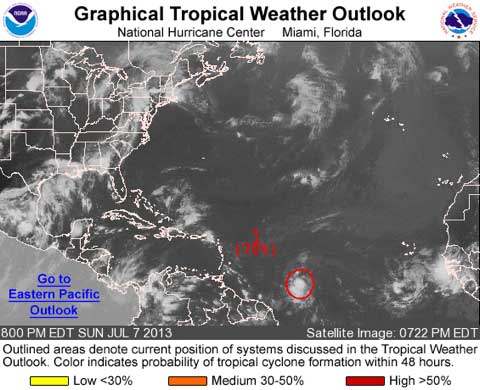
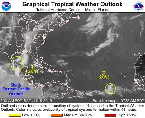
1. A STRONG TROPICAL WAVE LOCATED ABOUT 1050 MILES EAST-SOUTHEAST OFTHE WINDWARD ISLANDS IS MOVING WEST-NORTHWESTWARD AT AROUND 25 MPH. SATELLITE IMAGERY INDICATES THAT SHOWER AND THUNDERSTORM ACTIVITYHAS INCREASED IN ORGANIZATION SINCE THIS AFTERNOON. ENVIRONMENTALCONDITIONS ARE CONDUCIVE FOR ADDITIONAL DEVELOPMENT...AND THISDISTURBANCE COULD BECOME A TROPICAL DEPRESSION OR TROPICAL STORMLATER TONIGHT OR ON MONDAY. THIS SYSTEM HAS A HIGH CHANCE...70PERCENT...OF BECOMING A TROPICAL CYCLONE DURING THE NEXT 48 HOURS.IF DEVELOPMENT OCCURS...TROPICAL STORM WARNINGS WOULD LIKELY BEISSUED FOR PORTIONS OF THE LESSER ANTILLES. REGARDLESS OFDEVELOPMENT...THIS SYSTEM IS EXPECTED TO PRODUCE LOCALLY HEAVYRAINS AND WINDS TO TROPICAL STORM FORCE IN SQUALLS OVER PORTIONS OFTHE LESSER ANTILLES ON MONDAY NIGHT AND TUESDAY. AN AIR FORCERESERVE HURRICANE HUNTER AIRCRAFT IS SCHEDULED TO INVESTIGATE THEDISTURBANCE ON MONDAY AFTERNOON.
Will report more tomorrow as we secure and see how things look in Marin.
Hurricane Blog Entries
Part 1 Hurricanes - Watching the Weather
Part 2 Tropical Storm Likely
Part 3 Tropical Storm Chantal is Coming
Part 4 Securing in a Mangrove
Part 5 Tropical Storm Chantal Arrives
Part 6 Tropical Storm Moves Off
We filmed all this for an episode in Season 9 - Martinique Tropical Storm here on Vimeo
Check out the whole Tropical Storm Adventure plus lots more sailing on Season 9 Distant Shores on Vimeo in Hi-Def Download
Hurricanes - Watching the Weather
Here is their forecast from this morning at 0800 (Click here for their link)
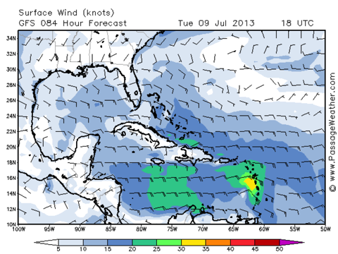
We also check the online weather forecasts from Passageweather here which is showing a 30-35 knots as the wave passes on Tuesday evening. It is currently predicted to pass directly over Martinique where we are...
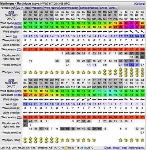
Here is my other favourite with the spot forecast for Martinique at Windguru
Hurricane Hole - We are on the south east corner of Martinique and will be using the excellent harbour of Marin as an anchorage for this wave/storm as it passes on Tuesday. We had been planning a trip to the east side to gunk-hole some of the amazing coastline of Martinique, and since the weather is predicted to be lovely today and tomorrow we will proceed with this plan, and come back tomorrow evening, then in to Marin in the morning on Monday after getting another storm update!
Hurricane Blog Entries
Part 1 Hurricanes - Watching the Weather
Part 2 Tropical Storm Likely
Part 3 Tropical Storm Chantal is Coming
Part 4 Securing in a Mangrove
Part 5 Tropical Storm Chantal Arrives
Part 6 Tropical Storm Moves Off
Boat washes up on the beach
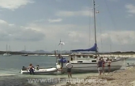
This happened in an anchorage in the Balearic Islands a few years ago - thankfully not to us. We had been keeping a close eye on the weather and had left the anchorage before the storms approach. When we came back to the anchorage there was a boat up on the beach where the storm had thrown her. She drew more than 5 feet and you could walk all around her without getting your knees wet! She was well up the beach and after trying a number of ideas it was impossible to pull her back to sea.
Winching, pulling, a line to the masthead to lean her? No Way! She was well and truly planted as the sand had reformed around her keels (she had twin bilge keels) and she was sitting in perhaps 6 inches of water with her keels down three feet in the sand.
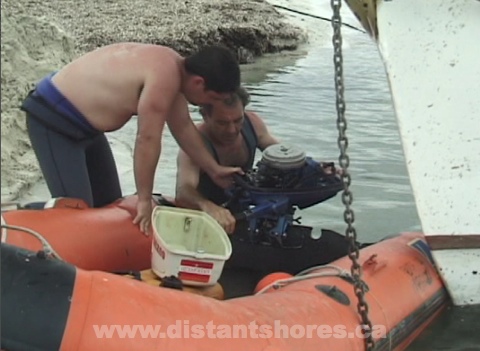
It turned out the solution was to use a couple of small outboard engines?!? Starting by digging a small hole in the ankle deep water - the small dinghy outboard could be run as a fan blowing sand out to make a wading pool than a larger and larger pool. After a couple of hours there is room to move in a more powerful outboard.
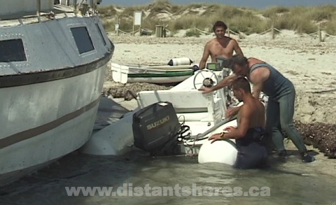
More and more water flowed back into the pools until finally the yacht was nearly floating in her own swimming pool. Incredible that a small engine could move what must have been 100 tons of sand. It did require a bit of TLC afterwards!!
We filmed this exercise and it is included in the first season of Distant Shores on DVD the episode is also available for digital download here on Vimeo.
Weather - Passage Planning
Traditionally we have “Pilot Charts” that summarize the winds, waves currents and typical sailing routes for various areas of the world over the last number of years. In the old days they were all you had to gauge what conditions to expect. But they are really just averages of past years. So they will only give you a probability of average winds. So for us planning a return to Britain from Sweden we could see we would have many days of southwest winds. In advance I used this to plan our schedule. Knowing we would often have headwinds I built in a number of delay days for our passage plan. We also planned to return across Sweden via the Gota canal since we could always do that regardless of headwinds.
But as the time gets closer it is possible to use some of the amazing resources of the Web to get better information. Watching up to 10 days in advance we can see if we should hurry off now with a minimum weather window or hold on for improving conditions.
Here in Europe I have a few nice sites that give long range predictions...
http://www.windfinder.com/forecasts/ <-- 7 day winds animation
http://www.ecmwf.int/products/forecasts/ <-- 10 day pressure predictions
But looking at the pilot charts and the current forecasts isn’t going to make you into a weather expert (not immediately anyway!). My biggest problem is that we are always new to an area and don’t have “local knowledge”. Here in the North Sea area winds often prevail from the southwest - but does that mean 2 out of 3 days the wind is from that direction or for 10 days followed by 5 days from somewhere else? I have found studying the weather patterns from previous years can help with this. Pilot charts are a statistical summary, but now with the internet you can go back and study in detail what happened in past years.
I take a few hours and look around to see what the weather looked like in past years. From our crossing of the Bay of Biscay I found some amazing sites going back years with detailed information - here is a specific site with sea buoys in a variety of places.
http://www.tutiempo.net/en/Climate/ENVIRONM_BUOY
Got to run - off across the IJsselmeer toward Amsterdam!
Force 8 Sailing
Sailing in a Gale
We were tied up in a secure harbour on the Sunday morning. The wind was already blowing in gusts over 30 knots and it looked like nobody was going to go out sailing. The weather service on the VHF was forecasting a gale warning. But I saw an opportunity to give the new boat a decent test in strong winds! Looking at the chart I saw a harbour just 25 miles down the coast which would mean we could sail with an offshore wind on the beam. So we wouldn’t be in big seas and would have a chance to try out the boat in strong winds for just a few hours. Perfect...
We battened everything down, untied, and headed out from the tiny harbor of Gislövs Läge. I had planned to sail with a double reefed main and reefed job, but there seemed to be more wind than forecast so we just partially unfurled the jib (no mainsail). The wind gusted over 30 and we scooted along at more than 8 knots - hitting 9. As soon as we got further out the wind stabilized a bit at 25-30 with gusts 35-40. But I had been right that we would have a nice comfortable ride since the wind was offshore - we never saw waves bigger than 1 meter.
The image doesn’t show it so well but you can see the bow wave being blown off in spray in the gusts. But also you can see the waves weren’t high.
We averaged over 8.2 for the 3 hours it took to reach Ystad. The boat was perfectly balanced and easy to steer. Dry decks and a comfy ride! The longer boat at 49 feet really does make for more comfort. During the whole sail we saw one other boat - a 40 footer close-hauled and motor-sailing west (the other way). Incredibly he was towing his dinghy - which naturally had flipped upside down. He must have been having a bad time since he just ignored it and kept on going with it upside down.
The only other boat we saw was just as we approached Ystad - the local Search and Rescue cutter came out and zoomed past in a cloud of spray. Winds gusted here at 40 knots - occasionally higher. We sailed right up to the harbour at Ystad and came in to find a dock. Thankfully the winds were lower close in shore since the harbour was quite full. But friendly cruisers grabbed lines as we came in to raft up. Praise to our big fenders and bow thruster so maneuvering in these tight conditions was no problem.
As a postscript to this story I found a news item the next day that 4 sailors had been rescued by Polish SAR in that same gale just over a hundred miles to the southeast.
We had a great sail however. It felt good to have tried the boat out in these conditions when it would have been easy to just stay put. Now we have more experience with how our new boat handles in strong winds so if we’re ever caught out in bad weather on a passage we now know that she handles winds up to 35-40 knots quite nicely with just a reefed jib. We filmed this in Episode 86 Distant Shores downloadable here in Vimeo - click on Episode 86
For more on stormy sailing check out our other blogs on Storms
Plan your passages around the world with us aboard Distant Shores
Order the Super Pack on DVD and get Season 1-10 Downloadable.
Order the Super Pack on Vimeo and we will send you the code for Season 10 as a bonus.